electro3 1 scaled

Power Line Inspection

Scheduled Inspection without Unnecessary Risks

Raybird enables large-scale inspection of power lines without involving ground or aerial equipment — making it more cost-effective, faster, and safer. The drone performs aerial imaging, detects damaged sections, identifies wire positioning on poles, and helps monitor high-risk zones. With high resolution and precise geolocation, the data can be used to create maps, reports, and maintenance plans. Raybird can cover hundreds of kilometers in a single flight — without the need for heavy infrastructure or a runway
litakind 1
detalizaciya tochnist
High Accuracy and Detail
Raybird is equipped with cameras capable of aerial photography at a 1:1000 scale — sufficient to detect cracks, displacements, and mounting issues
nadskladni umovy
Access to Hard-to-Reach Areas
Thanks to autonomous ground launch, Raybird can take off right next to the power lines — with no need for runways, helipads, or special conditions
2500 1
Longer Flight = More Data
Up to 30 hours in the air, 2500+ km range — Raybird covers large areas in a single flight, minimizing logistics costs and time spent on data collection
avtonomnist
Automation and Repeatability
Raybird performs flights along pre-programmed routes, enabling regular inspection of the same areas and tracking changes in the condition of poles, fixtures, and wire alignment
pic 75x55sm 7 1

No Helicopters. No Delays. Full Control

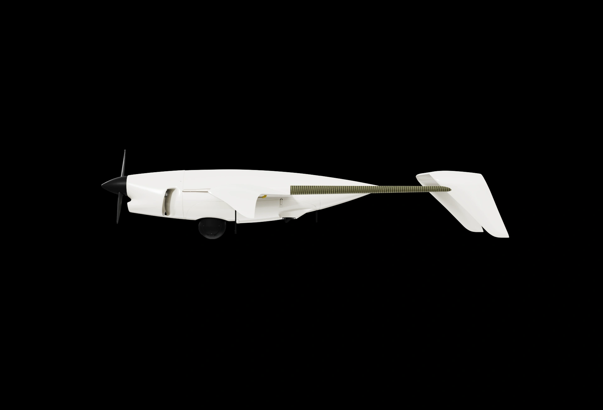
Raybird simplifies power line inspection by reducing logistics costs, minimizing risks to personnel, and eliminating the need for heavy equipment. No helicopters, no lifts, no field crews — just a flight along a pre-defined route. Raybird captures high-resolution aerial imagery, identifies potentially hazardous areas, and lays the groundwork for maintenance planning

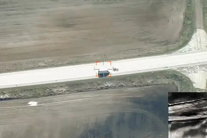
With precise positioning and 1:1000-scale imaging, its camera detects microcracks, misalignments, and mounting issues — all without approaching the structure

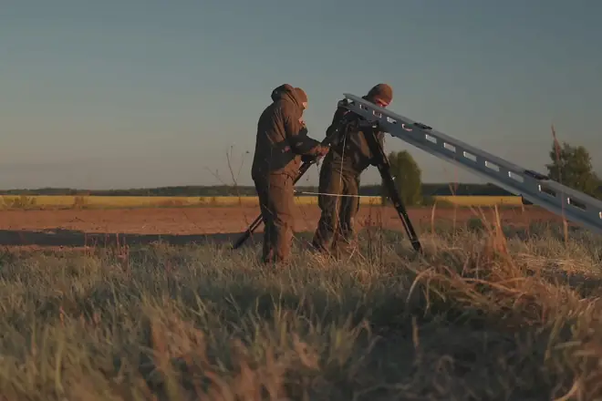
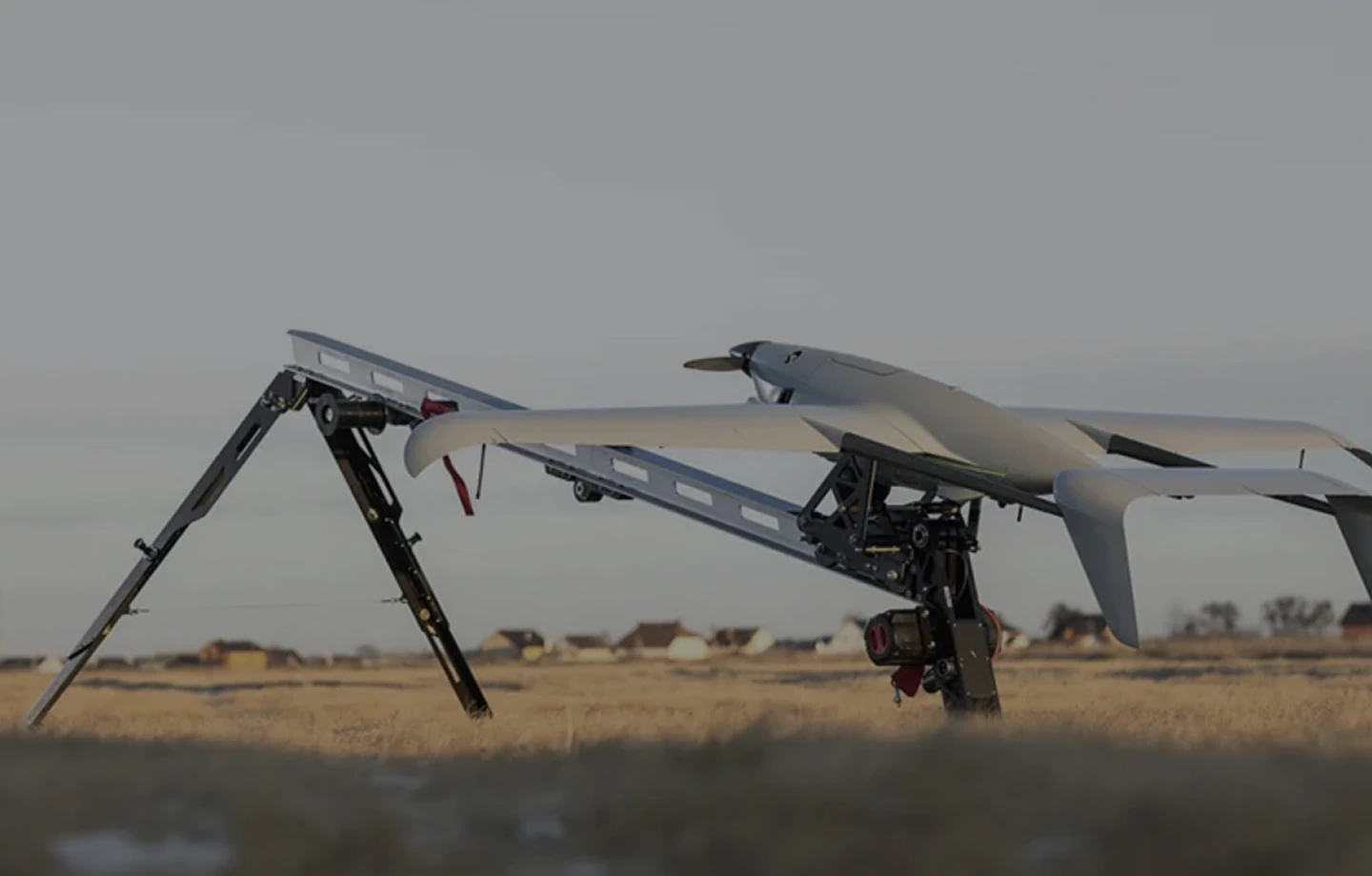
Launch without a runway allows operations directly along transmission routes. This is critical in challenging regions — mountains, swamps, forests — where other systems lose efficiency or can’t operate at all

A single Raybird flight covers hundreds of kilometers of infrastructure. It automatically follows pre-set routes, making it easy to track changes in pole conditions, fastenings, and wire alignment over time. Routine aerial surveys become an early warning system — without human error, delays, or extra costs

Footer (1)

Request Presentation


    group 1
    Privacy Overview

    This website uses cookies so that we can provide you with the best user experience possible. Cookie information is stored in your browser and performs functions such as recognising you when you return to our website and helping our team to understand which sections of the website you find most interesting and useful.